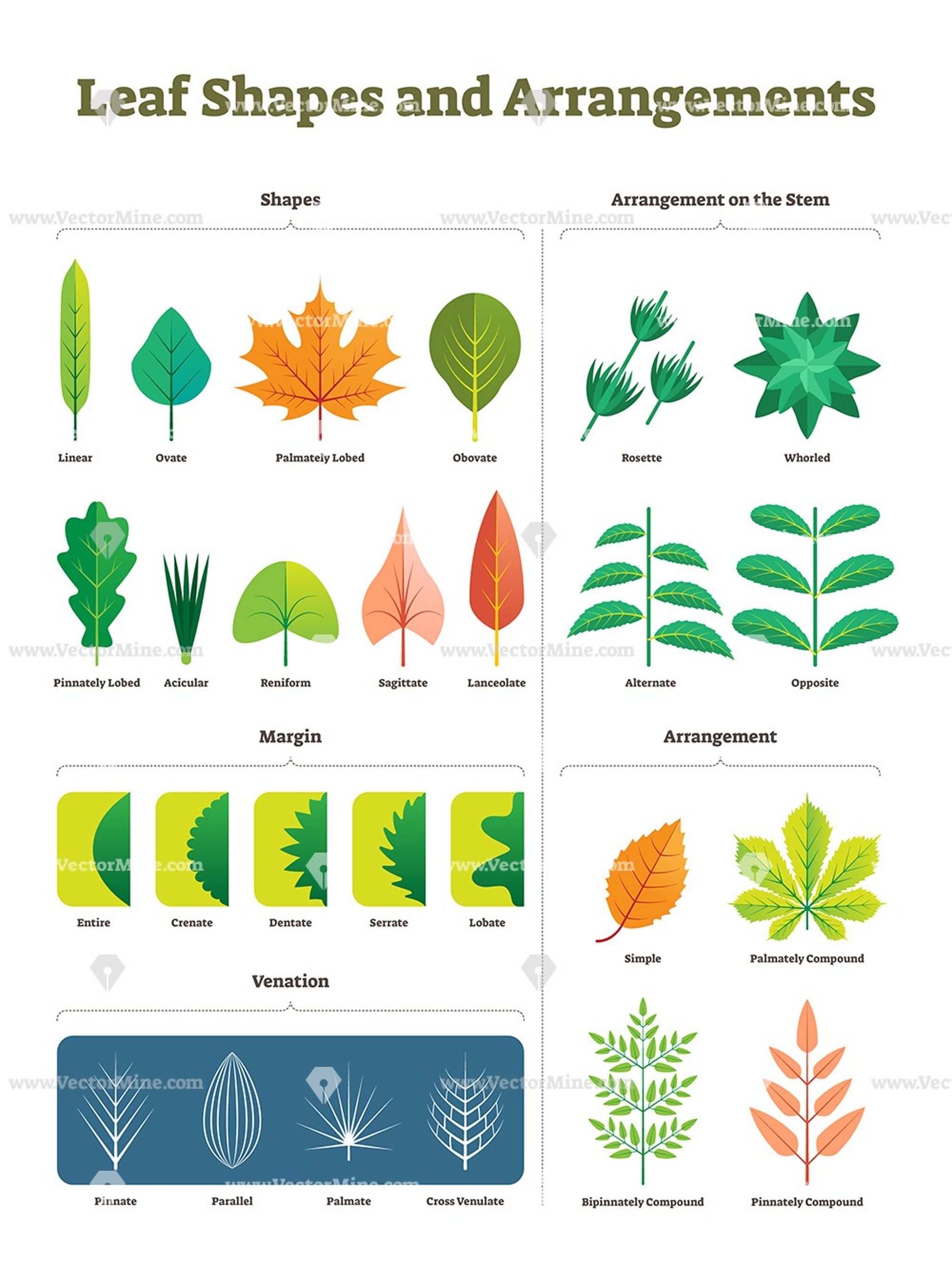
Plant anatomy can help classify species, especilly if you know the terms to enter in the search engine.
Elevation and Lattitude
In 1889 C. Hart Merriam studied the distribution patterns of plants and animals in a broad swathe from the lower elevations of the Grand Canyon to the top of Humphreys Peak (elevation 12,760 ft) in the San Francisco Mountains near Flagstaff, Arizona. Based on his observations in the field, Merriam developed the concept of a Life Zone, a belt of vegetation and animal life that is similarly expressed with increases in altitude and latitude.
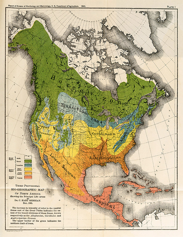
In 1889, Merriam visited Arizona’s Colorado Plateau and published the results of his survey of the San Francisco Mountain region and the desert of Little Colorado, Arizona. He chose this region because “of its southern position, isolation, great altitude, and proximity to an arid desert.” He believed a new scientific understanding of the diversity of physical and climatic conditions and how they related to life forms could be obtained. The Madrean Sky Islands, or Madrean Archipelago, is a world biodiversity hotspot in northwestern Mexico and the southwestern United States. This ecoregion is named for the 55 pine- and oak-studded mountain “islands” encompassed within and separated by desert and grassland “seas.” When you climb a Sky Island mountain in the summertime, you start in the desert where the daytime temperature may reach 120° Farenheit and you end up on a mountaintop where the temperature is perhaps 75° Farenheit and you feel comfortable wearing a jacket. This dramatic change in only a few miles results in equally dramatic plant changes. It is estimated that going up 1,000 feet in elevation is roughly equivalent to going 165 miles to the north, so in only a few miles climbing you can see plant changes equivalent to traveling hundreds of miles northward.
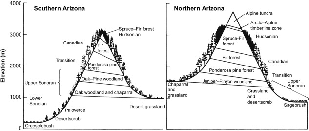
In Arizona, where relief is high, Merriam delineated six different life zones and correlated these with latitudinal vegetation zones ranging from Sonora, Mexico, to the Arctic coast of Canada. He tried unsuccessfully to associate the boundaries of his life zones with mean annual temperatures; to match faunal distribution patterns to his zones; and to apply them on a continent-wide basis; yet the basic scheme survived and continues to be used by researchers in western North America. For descriptive purposes Merriam’s life zones are a simple, straight-forward classification of readily observed vegetation patterns that work well in the area in which they were devised. Life zones, as an organizational concept, has been applied to many other mountains and mountain ranges. The life zones are lower on the south side than on the north, because exposure to direct sunlight makes the south side warmer and drier.
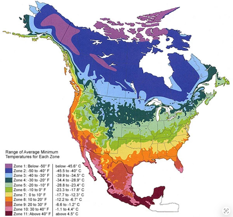
For well over a century, Dr. Merriam's work has proven useful to American farmers and gardeners. His North American life zones map eventually evolved into today's USDA plant hardiness map.
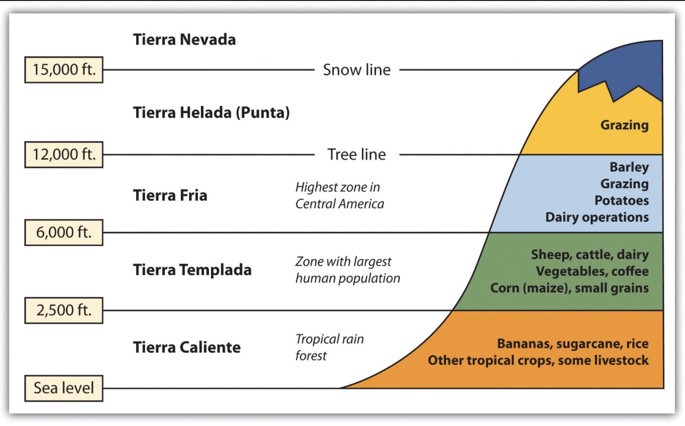
Vegetation zonation on mountains in the tropics does not replicate the latitudinal belts of vegetation of the middle and higher latitudes even though mountain peaks may extend well above snowline. In part this is due to the fact that the seasonal cool and cold temperatures of the middle and high latitudes are not experienced in the tropics. Instead, it is diurnal temperature patterns that are important. At high elevations nocturnal frosts may occur nearly every day throughout the year; while daytime temperatures are quite warm. Seasons in the tropics are distinguished on the basis of precipitation patterns. Also, many of the world's largest deserts sit roughly 30 degrees north and south of the equator near the Tropics of Cancer and Capricorn. This occurs because intense equatorial heat drives moisture-laden air upward, which drops its rain and flows poleward before descending dry and warm at about 30 degrees latitude. Merriam did not include this mechanism, nor the shadow effect of mountain ranges, when he was doing his surveys.
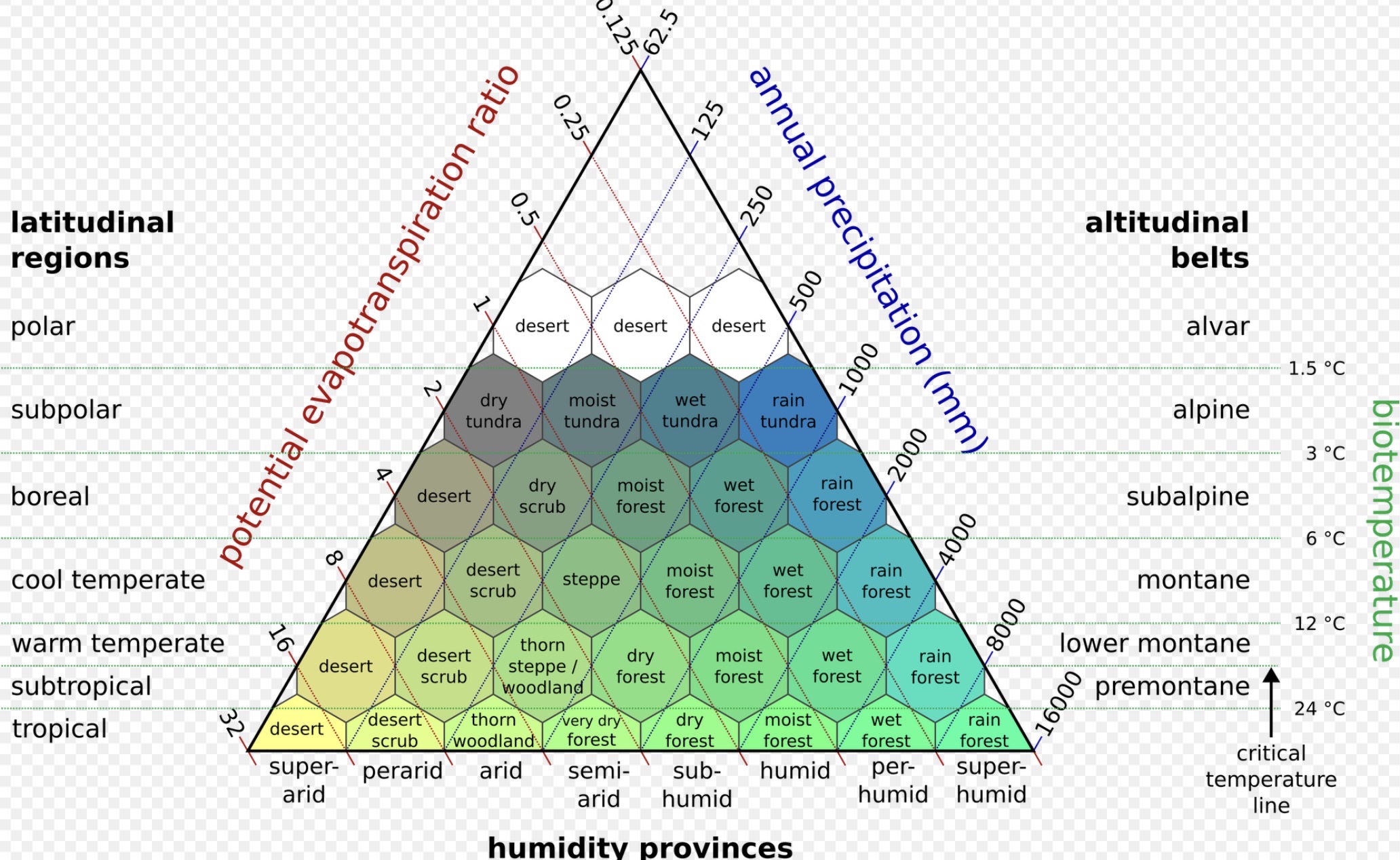
In 1947 Leslie Holdridge revised the concept of life zones to create what is known as Holdridge’s Life Zones. Holdridge's sysem is a more complex classification system. Holdridge's life zones are predominately based on three factors: Median Annual Biotemperature, Annual Percipitation, and Annual Evapotranspiration (water evaporated that will become rainfall). These factors are ever changing, which is why Holdridge’s system is useful for predicting enviromental change. While it was first designed for tropical and subtropical areas, the system now applies globally. The system has been shown to fit not just tropical vegetation zones,but Mediterranean zones, and boreal zones too, but is less applicable to cold oceanic or cold arid climates where moisture becomes the predominant factor. The system has found a major use in assessing the potential changes in natural vegetation patterns due to global warming. Biotemperature is based on the growing season length and temperature. Biotemperature refers to all temperatures above freezing, with all temperatures below freezing adjusted to 0 °C, as plants are dormant at these temperatures. Holdridge’s system uses biotemperature first, rather than the temperate latitude bias of Merriam’s life zones, and does not primarily use elevation. The system is considered more appropriate to the complexities of tropical vegetation than Merriam's system.
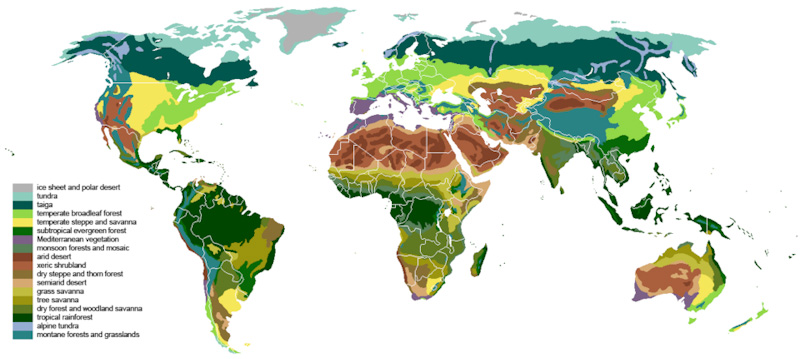
A biome refers to a region of the world characterized by its resident life, environment, and climate. Temperature, precipitation, and amount of sunlight all affect what type of life resides in a particular biome and help define each biome. There are a number of biomes around the world, including savanna, rainforest, desert, taiga, and marine biomes. The word ecosystem refers to the interaction between organisms living together in a particular environment. This definition encompasses both biotic and abiotic factors, such as water, climate, and soil. Additionally, ecosystems are defined by the flow of energy and nutrients throughout the system. A habitat is specific to a species or population of organisms. Wherever that population lives is its habitat. Specific combinations of plants and animals are the commonality of specific habits.
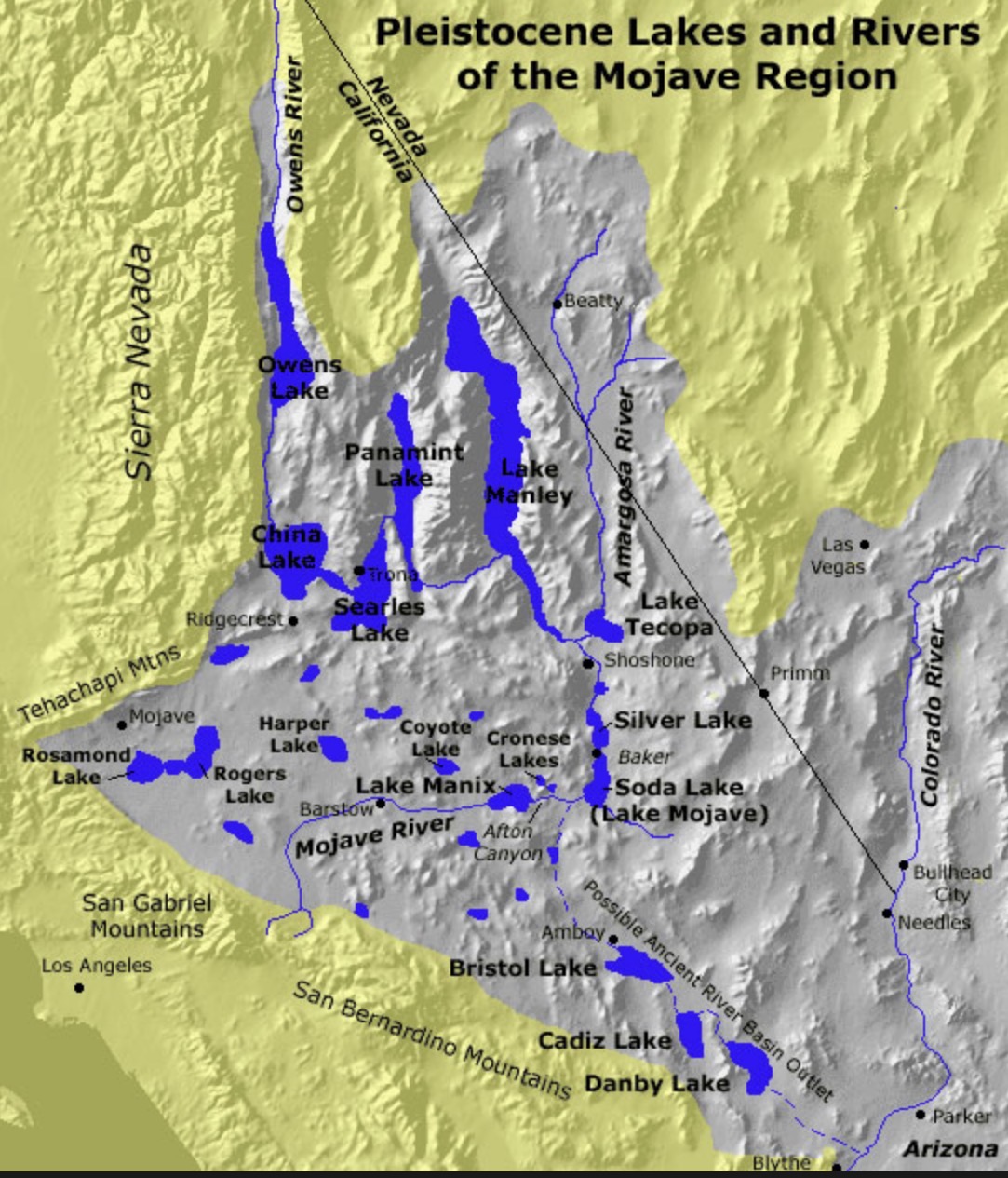
In the not too distant past, following the glacial maximum about 26,000–20,000 years ago, the Holocene glacial retreat began about 19,000 years ago. As the Owens Valley glacier melted it left a string of lakes that resulted as one after the other overflowed. The Owens valley was a very different place then, lush grasslands and dense forests. During the full-glacial, Owens Lake was located in a transitional position between the full-glacial single-needle pinyon-juniper woodlands of the Mojave Desert and the Utah juniper-limber pine woodland of the southern Great Basin. Lake levels at Lake Searles (downstream from Lake Owen) were generally high to overflowing between 25,000 and 10,000 years before present (BP). Between ca 21,000 and 15,000 yr BP a continuous highstand is inferred. This means the Owens Valley probably remained forested until at least around 10,000 yr BP. During a lengthy period beginning around 5,000 BCE, an episode of intense climatic warming was responsible for major changes in human, animal and plant settlement patterns and lifeways. The large lakes dried up and their associated resources were gone. Inhabitants were forced to seek living sites near dependable water sources: springs, streams, or small, isolated lakes, move to the mountains or adapt to the new climate.
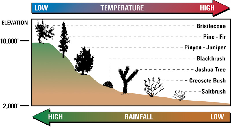
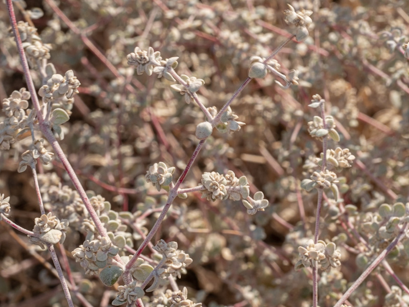
In some basins on the valley floors, particularly those with low nocturnal temperatures and very high soil salinity, the saltbrush community predominates. A good example of this community can be found on the valley floor between Corn Creek Field Station and Highway 95.
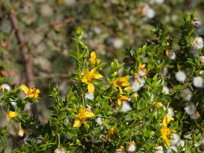
This open scrubland dominated by the creosote bush consists of widely spaced shrubs and various cacti. Other common species include Mojave yucca, bursage, and range ratney. This community receives less than 5†of rain per year.
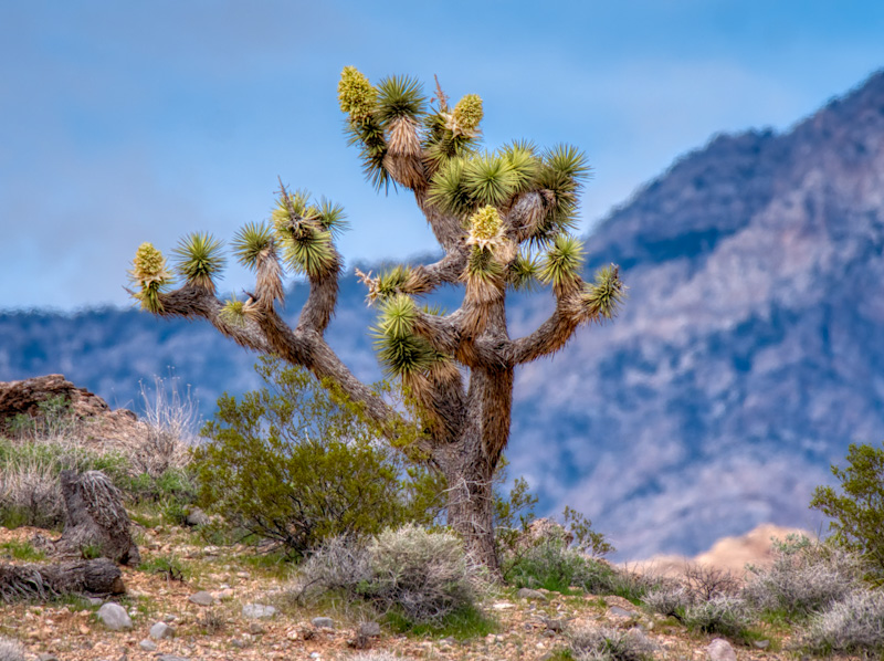
The apparently dominant species in this habitat type is the Joshua tree, although the bulk of plant material consists of a variety of widely spaced shrubs known as the understory.
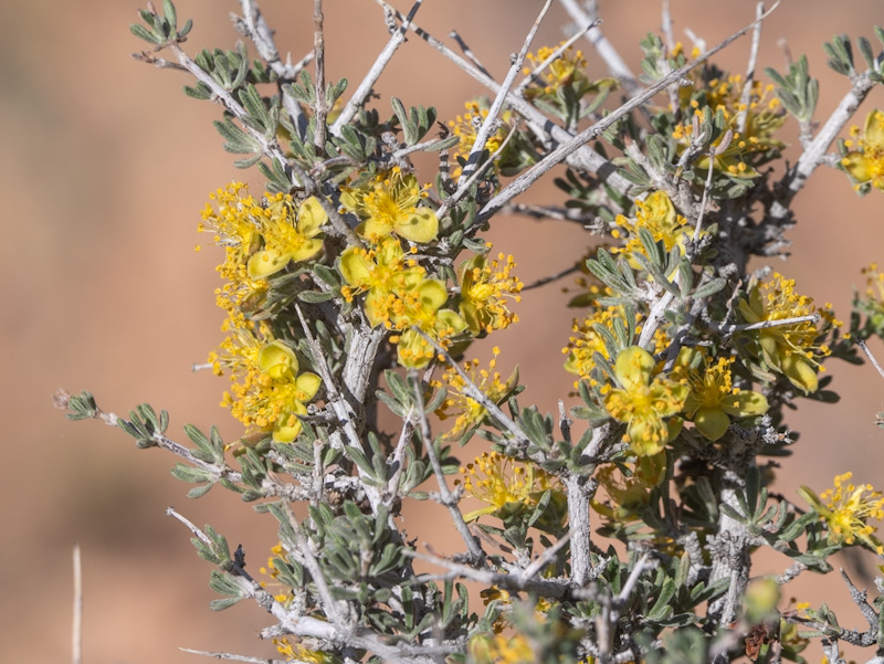
This community dominated by blackbrush is found on steep rolling hills. Soils are typically shallow. Different species of yucca, including Joshua tree, Mormon tea, and cholla cactus are common here.
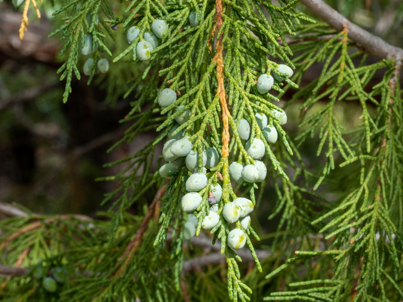
This open canopy forest occurs where precipitation may be 10–15†per year, much of which is received as snow. Utah juniper and single-leaf pinyon pine dominate this community that forms a zone between brush and true forest.
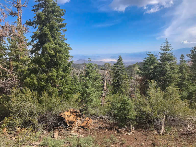
Where snow and rain linger, ponderosa pine and white fir are dominant. They form well developed, nearly closed canopy forests.
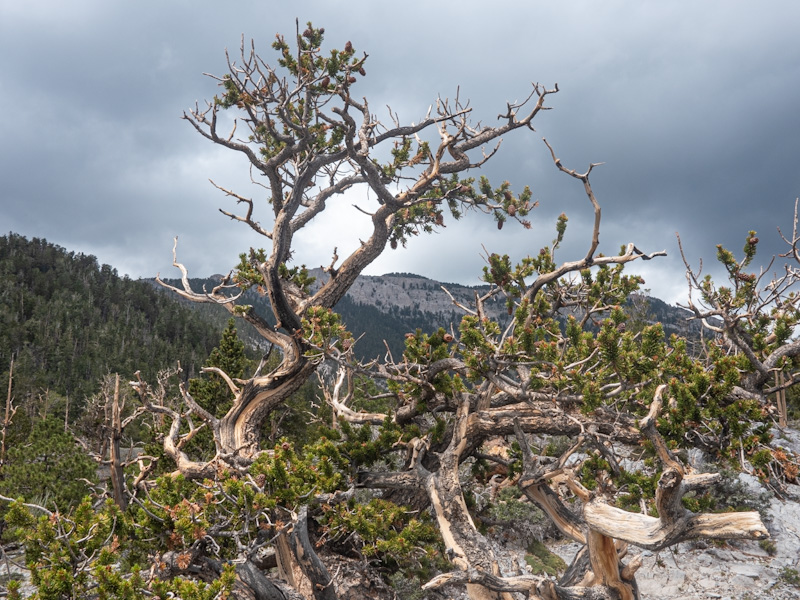
Where the growing seasons are the shortest, the only trees surviving the extreme conditions are the bristlecone pines. These very long lived trees are found in the Sheep Mountain Range.
The Geographic Distribution of Animals and Plants in North America: C. Hart Merriam
Merriam’s Life Zones of North America
The 4 Largest Deserts in North America are Stunning
Sky Islands: US Forest Service
Plant anatomy can help classify species, especilly if you know the terms to enter in the search engine.
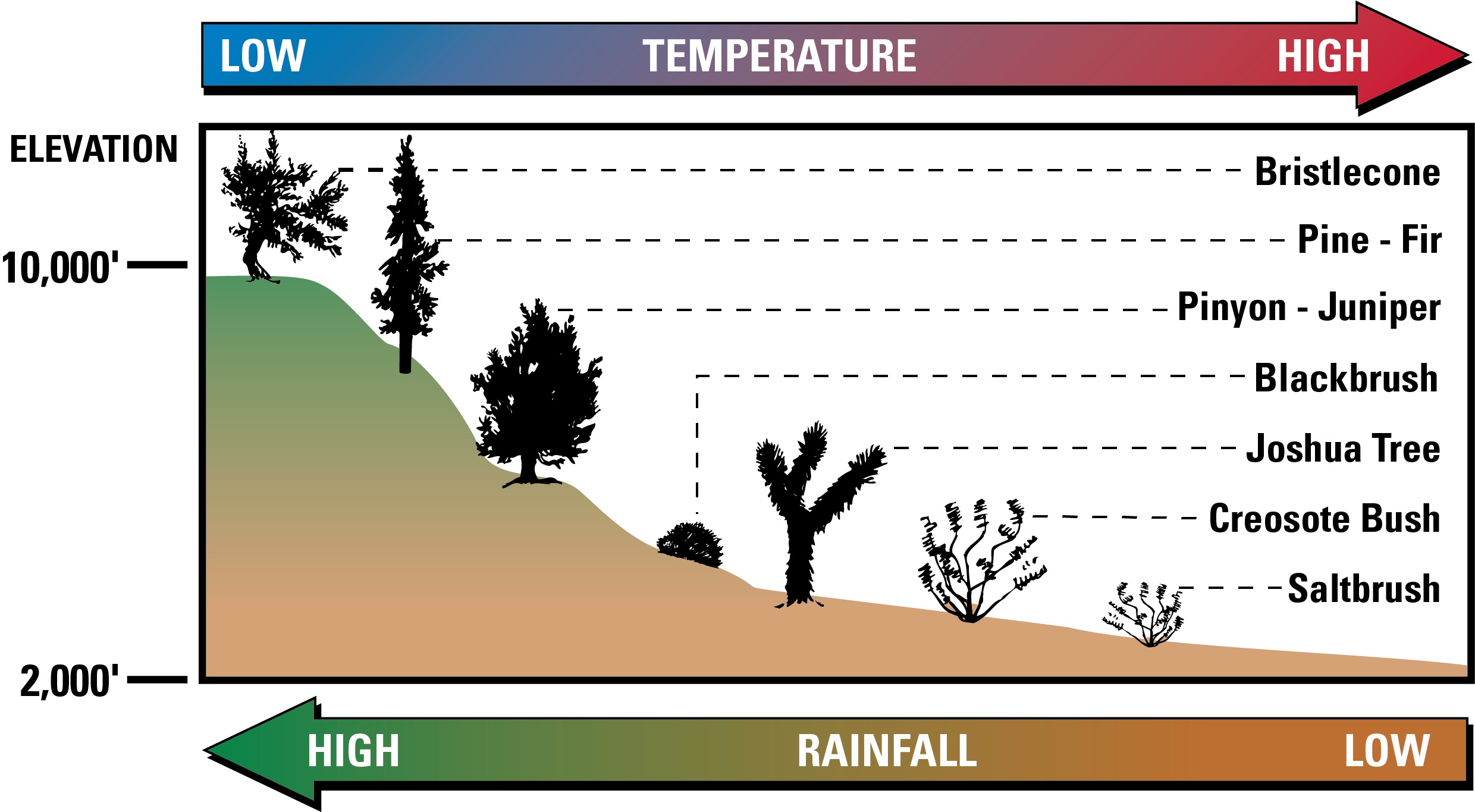
Mojave vegetation biomes
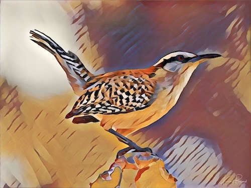
Bird Markings are often colorful and one way to identify species.
I am usually out hiking, birding or traveling but you can reach me at: